Monday, June 30, 2008
Back to go back
Sunday, June 29, 2008
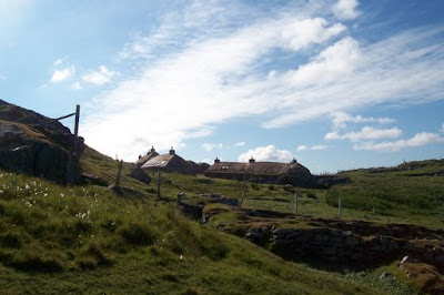
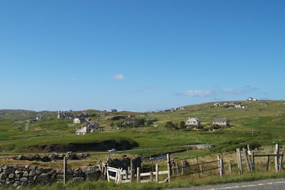
Western Isles: Berneray
Since the weather had improved, I pitched my tent at the youth hostel, after clearing away the sheep crap littering the ground first. The first night was good camping, but the second night the wind changed direction so that I was in the brunt of it. I was impressed with my wee Tesco tent - it shook like mad but it didn't collapse or come uprooted. It did make sleeping a bit harder that night - I used my earplugs to block out the noise of the flapping nylon.
I walked all around the island one day, going anti-clockwise from the youth hostel. It only took me about 4 hours and that was not at full tilt.
Looking out over a sizeable chunk of Bernerary from the top of one of its hills.
 After the rain stopped on the West Beach; it runs for about 3 miles up the west side of the island.
 I would bet that there's more sheep on Berneray than people.
 Houses along the island's main road.
I left the island Sunday. I was taking the ferry from Lochmaddy on North Uist to Uig on Skye. That particular ferry runs on Sundays, but nothing else does. It was about 10-12 miles from the hostel to the ferry, so I decided that I would walk that Sunday morning as my ferry wasn't until 11:50am. It wouldn't have been a bad walk except that the weather turned bad again and the wind blew fierce, against my direction of travel, and there was heavy rain much of the time just to make it that bit extra special. Needless to say I ended up wet; waterproofs are only waterproof for so long. I've been drier after soaking in a bath. It took me 3.5 hours in those conditions to reach the ferry terminal and the only thought that kept me going was that I could be dry again. I couldn't even have hitched a lift if I'd tried; the only traffic I encountered was going the opposite direction to me.
Anyway, I did make it, changed all my clothes but having only one pair of boots spent the rest of the day travelling to Inverness with slowly-drying feet.
Friday, June 27, 2008
Western Isles: Harris
We drove over the central moorland of Lewis before getting into Harris, where there's a lot of rocks to spare. The landscape started getting hillier as well.
My stop came just after it had started chucking it down with rain. I got off at Maaruig turn, 6km from the village of Rhenigidale where I was going to stay at another Gatliff Trust hostel. The village was only connected by road around 1990; prior to that it could be reached via a footpath from Tarbert or by boat.
I was getting aboslutely drenched and struggling up the hairpin bends of the hilly road when a car stopped for me, a couple who lived in Rhenigidale and offered to take me the rest of the way. Of course I hopped in, and they told me all about their neighbours in the village and who had been visiting PEI and Nova Scotia (after they had asked me where I was from).
I got to the hostel and dried out and warmed up with a cup of tea.
 Later when another girl arrived, sodden and tired on her bicycle, the warden stopped in and lit the fire for us. The girl, Thea from London, and I read and chatted over the next day, as it was blowing such a gale that we didn't dare go outside until sometime Thursday evening to ease our cabin fever was the weather had calmed down.
Finally seeing the village without rain hammering from the sky.

Friday morning I packed up my stuff and took the footpath that leads to Tarbert.
 It goes around a bay and then steeply up a hill that I was well glad to reach the top of. No matter how much I go up hills, they're always just as tough it seems. I don't do ascent well. Must have been quite the walk for the kids of Rhenigidale going to secondary school in Tarbert every day before the road was built.
 In Tarbert I sat in the sun and took in the scenery and read until time to take the bus southward to the ferry to Berneray, my next destination.
Wednesday, June 25, 2008
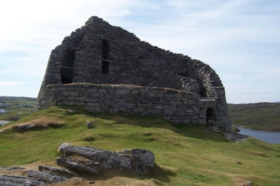
Western Isles: Lewis
My first afternoon there (after coming from Stornoway on what became the primary school bus - there's nothing like hearing 10-year-olds talking about when they were young to make one feel old), I just wandered around after setting up my tent, and napped in the sun by the shore in my tent.
The next day (Tuesday), I walked down the road to Carloway to visit the broch just past it. It's about 2000 years old, one of the last ones built, at a time when competition for good growing land was increasing due to climate change making things wetter and the trees disappear. It's a dry stone building - no mortar - and it's still solid as anything.
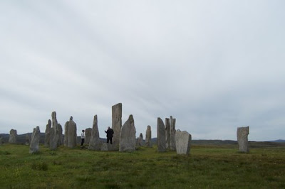
Then I went farther down the road to Callanish where I had lunch before visiting the standing stones. As you can see, they're irregular shapes but still pretty tall. Like all other standing stones there seems to be debate about their purpose with calendar and religious purposes topping the list.
Saturday, June 21, 2008
Back to Civilization
Friday, June 20, 2008
Cowal Way, Day 4: Lochgoilhead to Ardgartan
The view from up high was sensational, though I couldn't dawdle seeing it as it was windy and cold up there. I did get plenty of time to enjoy it during my breaks climbing up and then on the way down.
Once again, it was a Forestry Commission road that I followed out to Ardgartan, on Loch Long, where the Cowal Way ends. I then walked another few miles to Arrochar, where I grabbed some fish and chips for lunch before catching a train to Fort William, a scenic journey with views of Loch Lomond and some spectacular glens and Rannoch Moor. Then it was a bus to Inverness for the weekend.
And some more photos.
Leaving Lochgoilhead in the morning.
 Cows blocking my path; the younger ones ran but this one stood her ground.
 View back from the pass. Lochgoilhead is on the right, the pass I came through the day before would be in the middle area.
 I'd huffed and puffed to get up the hills, and then there were some sheep, grazing nonchalantly like it was just another day at the office to be up there (it was for them).
 You can just see Loch Long as I stand at the pass summit.
Thursday, June 19, 2008
Cowal Way, Day 3: Glenbranter to Lochgoilhead
The path was very good up until I got along a burn (stream) that led to a lochan (little loch) up on the pass. Then it got very boggy and uneven. The wind had picked up at that point, but it was on my back fortunately.
Then once past the lochan, the trail pretty much disappeared at times and where it existed it was really muddy. I had to pick my way down a hill, skirting cliffs around the base of a waterfall, and that took a while. Even so, I beat my guidebook's estimate of 7 hours walking time (I seem to walk faster than the person it estimates for) and came down into "outer" Lochgoilhead after 3pm. I spent the afternoon taking care of food and then hunting for a good place to camp, eventually deciding on a spot in the woods outside of the village, where there was no midges!
Now some photos.
I'd walked miles away from the road by now, and here were someone's cows and sheep pasturing. Trickier back fields to get to than farmers have in PEI.

Mist rising off the hills.
 Currain Lochan, very wavey due to a strong wind.
Cliffs I had to pick my way around coming down off the Lochain pass to get down to Lochgoilhead.

Waterfall.

Lochgoilhead, at the head of Loch Goil, of all things.

Wednesday, June 18, 2008
Cowal Way, Day 2: Glendaruel to Glenbranter
The walk for the day was to be not too long or hard, around 12-13 miles I think. I set off down the single-track road, probably the old "main" road as it ran parallel to the now main road. However, after a couple of miles where a bridge was supposed to be, I reached a "Road Closed" and construction site fence. The bridge was being repaired/replaced, and I couldn't pass through as it was a job site (hard hat, etc. required). Checking out my map, I saw no easy way around, nor an easy way to the main road that didn't involve risks of bogginess while cutting through pastures (after the mud incident of the day before, I was eager to not get covered in smelly mud early on in the day). So I walked back to the campsite and out to the main road around there. The main road met up with the next stage of the walk, staring at Garvie Burn onto Foresty Commission roads to go through to Glenbranter.
The walk through the forest had a few steepish hills, but was on a good track so not too bad really. It rained lightly and then it stopped and then it started again. I didn't see any people, just sheep, until I came out at Glenbranter Village, where there's houses and forestry offices, around 4pm. Glenbranter is along the river Cur, which runs into Loch Eck from the north-ish direction.
I'd decided to treat myself to a night in a bunkhouse (to dry out) and a cooked meal, so I caught a bus down the road after 5pm to the Whistlefield Inn, on the shore of Loch Eck, which you may remember me mentioning from the days when I lived a few more miles down the road from it. The bunkhouse was just like a hostel, with great heaters for drying things in front of, and I had an excellent burger for supper, Aberdeen Angus beef mixed with haggis.
Glendaruel, from the churchyard.
 An old archway on the road through Clachan of Glendaruel.
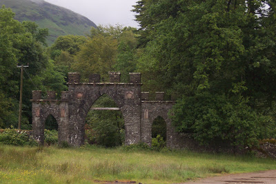
On the Forestry Commission road, sheep running from me. Even the ones in fields beside roads where they should see people often ran away from me. Maybe it was the backpack, gave me a weird shape to them. Looking back toward the hills surrounding Glendaruel (it would be on the right, with the wind turbines on the hill defining the left side of the glen).
 Coming down into Glenbranter.
Tuesday, June 17, 2008
Cowal Way, Day 1: Portavadie to Clachan of Glendaruel
The day got off to a poor start. I got up around 6am to pack and head for my bus from Dunoon to Portavadie at 7:11am. Turns out this bus did not exist on that day. I'd looked up timetables on Transport Direct's website (usually quite useful) as West Coast Motors did not have up-to-date timetables on its website. Well, the bus I wanted to take only existed on school holidays, and before the bus "didn't turn up" I already realized I was in trouble, as I had been on a bus taking a little trip out to the Coylet Inn with many school kids the day before - they clearly weren't on holidays yet.
So there was only one bus going to Portavadie that day, at 13:36 or thereabouts. If it had been a Wednesday, I could have taken a connecting bus, but it was a Tuesday. I figured that by the afternoon I could even walk the entire distance to Portavadie, and then I could certainly hitch a ride by then, so that was what I did. I walked out of Dunoon to where the road turns off to go westward, managed to hitch a lift with a forestry worker who was driving to Clachan of Glendaruel, and just after 9am we turned onto a road behind the bus that I could have connected to if it had been Wednesday, so he flashed it's lights to get it to stop. So I ended up arriving at Portavadie at 9:40am, not too bad afterall.
The walk for the day was to be around 15 miles to complete 2 stages, plus an extra mile or so to get to the campsite where I was going to stay the night. It was a fairly easy walk - gentle hills and roads, with the exception of a shoreline stretch that was quite tricky just north of Tighnabruaich. It was along slippy rocks and then up to a narrow, winding, up and down path through the woods because the tide was in. Anyway, I present a few photos first.
Ruins of castle by Loch Asgog (just after Portavadie). I fell in a muddy hole trying to get down to it and spent a lot of time cleaning my boots up at the public toilet in Kames.
 Walking along the shore to Tighnabruaich. That's Isle of Bute on the very right, but more of the Cowal peninsula in behind it.
 Bute again, now from north of Tighnabruaich.
You must be this small to walk the Cowal Way: rocks I had to squeeze through to continue on the path as the tide was high.
 The path goes up behind this rock into the woods. I wouldn't have found it without my guidebook (and even then it took some work).
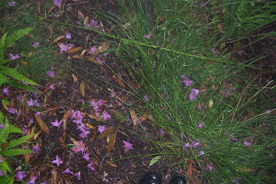
The forest path was hard up and down work, and it was raining heavily, but the ground was covered in pretty rhododendren petals.
 Just as I arrived in Clachan of Glendaruel it absolutely started chucking it down; the rain was bouncing off the road. I took shelter in the porch of the closed Glendaruel hotel, where some kind soul had even left the cushions off of the patio chairs so I sat comfortably on the wooden bench. As soon as the rain cleared, I made down the road to the campsite so that I could set my tent up before it started pouring again. I set it up in a misty rain. The tent held the water out alright, but many of things were still damp in the morning, not drying well in the humid environment.
Sunday, June 15, 2008
Off to Cowal
The Cowal Way is a 47 mile journey. The book I have outlines it as a 6-day trip but I'm going to do it in 4 days, possibly 3, as I know my fitness is such that I can do 15 miles a day over the terrain of some of the route even with a heavy pack. My pack will be heavy enough because I'm going to camp along the way - hostels are non-existant and even B&B's and hotels aren't plentiful. Plus, with a tent I can just stop walking at the end of the day when I feel like it and don't have to push myself onward just to get out of the elements for the night. I've picked up a small tent, a sleeping bag, and a foam sleeping mat (for comfort) from Tesco for £27 altogether. I'll use it for the remainder of my trip and then pass it on to someone else. The cost altogether is less than a night's stay in a hotel, afterall.
Just checked the weather forecast and it's improving. Tuesday, my first day of walking, is now predicted to be light rain, whereas it was heavy rain when I checked a couple of days ago. And it looks like it's clearing up some the next days. One can only hope.
So I won't be near any internet until probably the weekend, when I will report on the walking.
Thursday, June 12, 2008
Lairig Ghru
We left Inverness Tuesday afternoon, and took 3 different buses to get to Bramar 4 hours later. The first bus took us to Grantown-on-Spey (that's the biggest town in the Speyside whiskey district), then the next bus took us to Ballater. That journey was pretty cool; it was over winding, high-up roads in what I believe is the sub-arctic climate of the Cairngorms. No trees, just scrubby plants and livestock. We passed through Tomitoul, the highest village in Scotland.
At Ballater we had a wait of an hour before taking the bus to Braemar. From there, we walked about 6 miles to Inverey where we stayed the night at the youth hostel.
Wednesday morning we set out at 8am walking toward the Linn of Dee (a gorge that the River Dee passes through) and then the Lairig Ghru. We got a few rain showers in the first hours and we stopped at the Corrour Bothy for lunch. There we decided to put on our waterproof trousers (we'd only been wearing raincoats before) and it was fortuate that we did as it started to rain heavily, stopping from time to time.
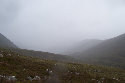
Hills we passed along the way - sorry, I don't know names.
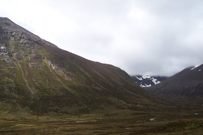
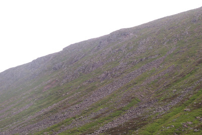
By the time we got to the Pools of Dee, just beyond the source of the River Dee (it runs all the way to Aberdeen), there were rocks all over the glen bottom, having fallen from the mountains on either side. I had been calling the first mountain we saw with loads of rocks on its sides the "gravel hill", but the rest of them were like that for much of the length of the valley.
The first "gravel hill".
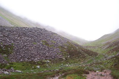
 The path is under those rocks:
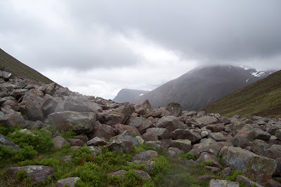 Path gets less rocky as it skirts around this little hill.
Just as we paused for a second lunch by a pool of Dee, it started to hail, so we started walking again. We spent a couple of hours picking our way through large rocks, often in heavy rain (the forecast that day had called for "scattered showers" but the weather is notoriously unpredictable and quick to change in the Cairngorms), so that our progress was much slower compared to the smooth wide path of earlier in the day.
I called this one the "Scary Hill"; it was shrouded in cloud much of the time (really, my namings are no different than the actual ones, they're just descriptive ones in Gaelic most of the time, and mine are in English). 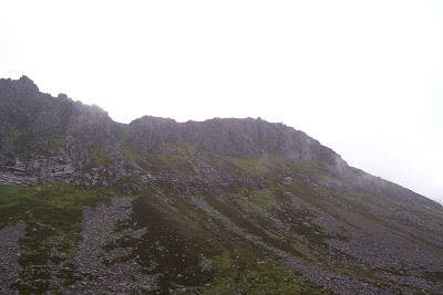
The path finally returned to rocky but existant farther along, by that time it was almost 3pm. We had made it over the top of the pass and could see Aviemore. So long as it rained, we kept moving with as short breaks as possible otherwise we just got cold. My boots and rain trousers had been saturated by the hail and so I was damp in the legs and wet in my feet, but oddly walking in wet socks felt quite comfortable and soft.
The heavy rain stopped as we came down off the pass. Tina's knee was hurting her, so we kept walking so as to get to the main road as quickly as possible. The last bit was through Rothiemurchis Forest along a nice path, so we made pretty decent time for those last miles and emerged in a caravan park at Coylumbridge just after 6pm. It would have been another half an hour walk along the road to Aviemore, and having just walked about 22 miles, we opted for calling a taxi, which was £5 well spent. 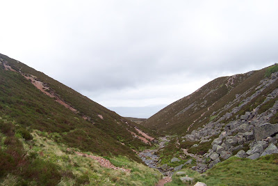
After one of the best hot showers I've had (courtesy of Aviemore Youth Hostel), we went to an Italian restaurant where we could watch the evening's EuroCup football match - Switzerland were playing Turkey, so we cheered on Tina's home team during dinner, but unfortunately the game was a draw which means Switzerland won't have enough points to advance. However, the dinner was excellent, and I even had room for dessert which doesn't often happen in a restaurant.
I can't put pictures up just now (using internet cafes), but may be able to next weekend when I get to the Inverness library.
Tuesday, June 10, 2008
Some scenic journeys
I could see all the peninsula of Argyll, and Loch Lomond, and then Ben Nevis (it is quite big) and Skye. Could pick out Loch Ness by it's length and see the Highland mountains to the north. As we neared Inverness airport, we got close up views of the Black Isle and the Moray coast, including Findhorn beach, and the Cairngorm Mountains in the near distance. It was really cool. If I'd had a flight like that a year ago, it wouldn't have been as cool because I didn't know enough geography to name things - it would have looked nice, but being able to put a name to the regions now made it better for me.
Then last week when I left Corrour, which is on the West Highland Line of the railroad, I took the train all the way to Mallaig. The West Highland Line is rated as one of the most scenic rail journeys in the world (it starts in Glasgow and I'm going to do that stretch up to Fort William later in the month).
The journey was indeed beautiful, with several places being stunning. Not being able to take pictures from inside a train very well, I was just going to direct you to some photos of the places I saw taken by other people. However, it has proved difficult to find a nice site with loads of pictures. I've put up a map here; the railroad is already marked on it and I've just put a few place names in to guide your eye. If you're really keen for photos, you could search place names in Google image search; I've linked to a few searches below.
Glenfinnan topped the list of stunning places. The railroad crosses the glen on the Glenfinnan Viaduct, now famous to the world for appearing in the Harry Potter films. The vantage point from the viaduct allows you to see either way down the glen. I could see the Glenfinnan Monument, which marks where ol' Bonnie Prince Charlie first started out on his campaign in 1745.
Photos of Glenfinnan: try here, here, Google image search here.
Other places: Loch Treig, Loch Eil, Lochailort, coast near Arisaig
Then from Maillaig, I took the ferry to Armadale on Skye. I have some of my own pictures of that, in this album.
Thursday, June 05, 2008
Sair feet
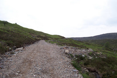
Well, Wednesday I packed some of my stuff into my backpack and headed to Fort William on the bus, from where I walked the couple of miles to Glen Nevis Youth Hostel. On Thursday morning, I set off on foot from there to walk through Glen Nevis on ward to Corrour, a 20 mile or so trip over all, where I would stay at Loch Ossian Youth Hostel.
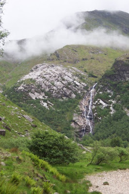
Glen Nevis is the glen at the base of Ben Nevis, the highest mountain in the country. Then a river or big stream called the Water Nevis according to my map, extends south and then eastward toward Loch Treig, and from there it's only a few miles to Loch Ossian. There's a path that runs along the river that I followed (using follow in a loose sense here).
It was a long day's walk. It started out in an area busy enough with other people walking out to see the gorge and Steall Falls. The midges weren't too bad as there was a bit of a breeze, but I did gradually accumulate some bites.
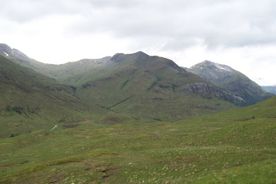
Then as I got farther into the glen, the number of people dwindled. I accidentally got away from my riverside path by following a path up a hill. I should have clued in much earlier that I was going along the wrong path, since I was climbing up the base of a Munro, but I was also quite hungry at the time and not thinking straight. I wanted to figure out where I was on my map before stopping to eat, but not being on the right path sort of interfered with that. Eventually I figured it out and headed back down to the valley, although having gotten a nice view while up the hill.
 By the time I descended again, there was no one else around. There wasn't even any midges, it's like they only stayed where the people were. For a few hours, it was completely silent save the occassional trickling noise of water and the sounds of my own footsteps - I didn't even hear any birds for a while.
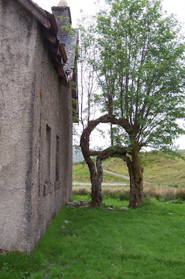
Just some interesting trees near a ruined house in the middle of the glen.
As I neared Loch Treig, I started to see people again, and then I neared the rail line and trains were going past. The last stretch coming up to Corrour was the absolute hardest - being tired from walking all day, I found I nice, long hill to climb, and not only that the sun came out and the breeze died down meaning that there were swarms of midges biting me as I sweated up the hill.
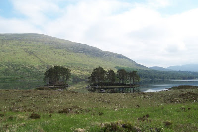
Finally, Loch Ossian and the hostel came into sight and I arrived to rest, hungry and with sore feet (hence the title), but after a good night's sleep I was brand new again.
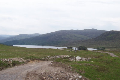
View from the youth hostel of Loch Ossian.
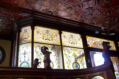
Wednesday, June 04, 2008
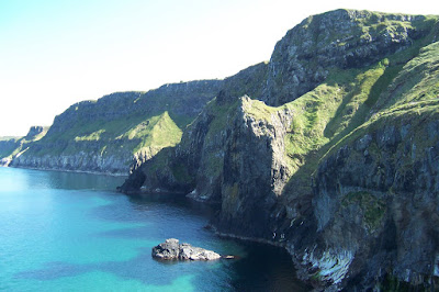
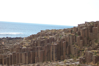
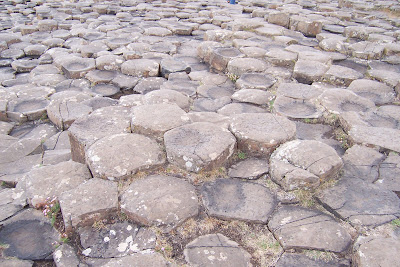
Northern Ireland

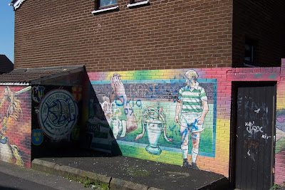
Some of the elaborate decorations at the Crown Bar.