The day got off to a poor start. I got up around 6am to pack and head for my bus from Dunoon to Portavadie at 7:11am. Turns out this bus did not exist on that day. I'd looked up timetables on Transport Direct's website (usually quite useful) as West Coast Motors did not have up-to-date timetables on its website. Well, the bus I wanted to take only existed on school holidays, and before the bus "didn't turn up" I already realized I was in trouble, as I had been on a bus taking a little trip out to the Coylet Inn with many school kids the day before - they clearly weren't on holidays yet.
So there was only one bus going to Portavadie that day, at 13:36 or thereabouts. If it had been a Wednesday, I could have taken a connecting bus, but it was a Tuesday. I figured that by the afternoon I could even walk the entire distance to Portavadie, and then I could certainly hitch a ride by then, so that was what I did. I walked out of Dunoon to where the road turns off to go westward, managed to hitch a lift with a forestry worker who was driving to Clachan of Glendaruel, and just after 9am we turned onto a road behind the bus that I could have connected to if it had been Wednesday, so he flashed it's lights to get it to stop. So I ended up arriving at Portavadie at 9:40am, not too bad afterall.
The walk for the day was to be around 15 miles to complete 2 stages, plus an extra mile or so to get to the campsite where I was going to stay the night. It was a fairly easy walk - gentle hills and roads, with the exception of a shoreline stretch that was quite tricky just north of Tighnabruaich. It was along slippy rocks and then up to a narrow, winding, up and down path through the woods because the tide was in. Anyway, I present a few photos first.
Ruins of castle by Loch Asgog (just after Portavadie). I fell in a muddy hole trying to get down to it and spent a lot of time cleaning my boots up at the public toilet in Kames.
 Walking along the shore to Tighnabruaich. That's Isle of Bute on the very right, but more of the Cowal peninsula in behind it.
 Bute again, now from north of Tighnabruaich.
You must be this small to walk the Cowal Way: rocks I had to squeeze through to continue on the path as the tide was high.
 The path goes up behind this rock into the woods. I wouldn't have found it without my guidebook (and even then it took some work).
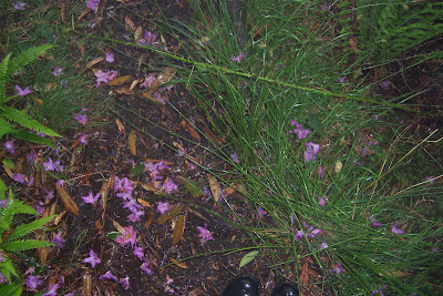
The forest path was hard up and down work, and it was raining heavily, but the ground was covered in pretty rhododendren petals.
 Just as I arrived in Clachan of Glendaruel it absolutely started chucking it down; the rain was bouncing off the road. I took shelter in the porch of the closed Glendaruel hotel, where some kind soul had even left the cushions off of the patio chairs so I sat comfortably on the wooden bench. As soon as the rain cleared, I made down the road to the campsite so that I could set my tent up before it started pouring again. I set it up in a misty rain. The tent held the water out alright, but many of things were still damp in the morning, not drying well in the humid environment.
2 comments:
Post a Comment