We left Inverness Tuesday afternoon, and took 3 different buses to get to Bramar 4 hours later. The first bus took us to Grantown-on-Spey (that's the biggest town in the Speyside whiskey district), then the next bus took us to Ballater. That journey was pretty cool; it was over winding, high-up roads in what I believe is the sub-arctic climate of the Cairngorms. No trees, just scrubby plants and livestock. We passed through Tomitoul, the highest village in Scotland.
At Ballater we had a wait of an hour before taking the bus to Braemar. From there, we walked about 6 miles to Inverey where we stayed the night at the youth hostel.
Wednesday morning we set out at 8am walking toward the Linn of Dee (a gorge that the River Dee passes through) and then the Lairig Ghru. We got a few rain showers in the first hours and we stopped at the Corrour Bothy for lunch. There we decided to put on our waterproof trousers (we'd only been wearing raincoats before) and it was fortuate that we did as it started to rain heavily, stopping from time to time.
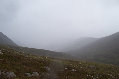
Hills we passed along the way - sorry, I don't know names.
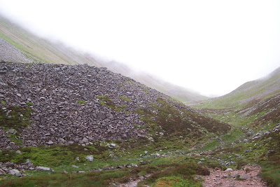
By the time we got to the Pools of Dee, just beyond the source of the River Dee (it runs all the way to Aberdeen), there were rocks all over the glen bottom, having fallen from the mountains on either side. I had been calling the first mountain we saw with loads of rocks on its sides the "gravel hill", but the rest of them were like that for much of the length of the valley.
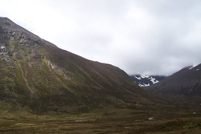
The first "gravel hill".
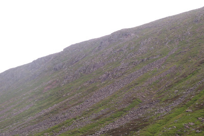 The path is under those rocks:
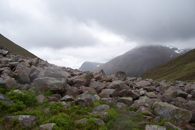 Path gets less rocky as it skirts around this little hill.
Just as we paused for a second lunch by a pool of Dee, it started to hail, so we started walking again. We spent a couple of hours picking our way through large rocks, often in heavy rain (the forecast that day had called for "scattered showers" but the weather is notoriously unpredictable and quick to change in the Cairngorms), so that our progress was much slower compared to the smooth wide path of earlier in the day.
I called this one the "Scary Hill"; it was shrouded in cloud much of the time (really, my namings are no different than the actual ones, they're just descriptive ones in Gaelic most of the time, and mine are in English). 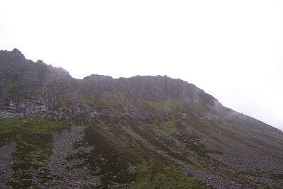
The path finally returned to rocky but existant farther along, by that time it was almost 3pm. We had made it over the top of the pass and could see Aviemore. So long as it rained, we kept moving with as short breaks as possible otherwise we just got cold. My boots and rain trousers had been saturated by the hail and so I was damp in the legs and wet in my feet, but oddly walking in wet socks felt quite comfortable and soft.
The heavy rain stopped as we came down off the pass. Tina's knee was hurting her, so we kept walking so as to get to the main road as quickly as possible. The last bit was through Rothiemurchis Forest along a nice path, so we made pretty decent time for those last miles and emerged in a caravan park at Coylumbridge just after 6pm. It would have been another half an hour walk along the road to Aviemore, and having just walked about 22 miles, we opted for calling a taxi, which was £5 well spent. 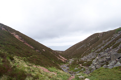
After one of the best hot showers I've had (courtesy of Aviemore Youth Hostel), we went to an Italian restaurant where we could watch the evening's EuroCup football match - Switzerland were playing Turkey, so we cheered on Tina's home team during dinner, but unfortunately the game was a draw which means Switzerland won't have enough points to advance. However, the dinner was excellent, and I even had room for dessert which doesn't often happen in a restaurant.
I can't put pictures up just now (using internet cafes), but may be able to next weekend when I get to the Inverness library.
No comments:
Post a Comment